Where the Crowds Don't Follow: Oxford's Quiet Canal and Stream Walks
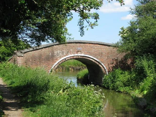
Photo: Sarah Charlesworth , CC BY-SA 2.0, via Wikimedia Commons
Oxford's famous river walk has a lot going for it: Christ Church Meadow, the Thames Path, Iffley Lock, a ice cream at the end. It also has a lot of people on it. The quieter alternative is not a secret exactly — locals have been walking it for years — but it is easily missed by visitors who stick to the postcard route. This is a guide to the water that runs around the edge of the city rather than through its front room.
Start at Isis Lock, not Carfax
Begin in Jericho at Isis Lock, where the Oxford Canal meets the Thames. The canal opened in 1790 and once carried coal and timber into the city; now it carries narrowboats, herons and the occasional cyclist who has not read the sign about giving way. The towpath north towards Wolvercote is flat, easy and almost entirely free of tour groups.
Walk for ten minutes and the city starts to loosen. Behind you are the rooftops of Jericho; ahead are moored boats, allotments and the kind of scruffy greenery that makes Oxford feel less like a film set and more like a real place. The stretch from Walton Well Road to Wolvercote is about three miles and takes roughly an hour at a gentle pace. It is not a wilderness walk — you are never far from a road — but it is a good one.
Castle Mill Stream: short, scruffy, surprising
Castle Mill Stream is the odd one out. It runs from the canal near Hythe Bridge Street, slips behind Oxford Castle and the old mills, and eventually finds its way to the Thames near Folly Bridge. It is not a continuous promenade. You will pop out at streets, cross roads, and wonder whether you are allowed to keep going. That is part of the charm.
The stream powered mills in the medieval city, and the name still clings to the old industrial edges. Start near Hythe Bridge Street, walk behind the castle and follow the water where you can. The route is patchy, so treat it as a short urban exploration rather than a full-day hike. The Anchor pub sits nearby, and the Punter on Osney Island is a good reward if you extend towards the Thames.
Port Meadow and the canal loop
The classic quiet loop is canal north, Port Meadow back. From Wolvercote, cross to Port Meadow and follow the Thames Path south towards Binsey and Osney. Port Meadow is ancient common land, mentioned in the Domesday Book and still grazed by cattle. It is also flat, open and frequently muddy. In summer it is glorious; in winter it can be a bog with a view.
The full loop from Jericho to Wolvercote and back via Port Meadow is about four miles. Allow two hours with stops. The Perch at Binsey is the obvious pub stop, though it is worth booking at weekends. The Trout at Wolvercote is another good option, and the Jericho Tavern is waiting back at the start if you want to end where you began.
Route notes and honest warnings
The towpath is narrow in places and shared with cyclists. Keep left, keep your dog close, and do not step onto moored boats without an invitation. After heavy rain, sections between Jericho and Wolvercote can flood; check the Environment Agency flood warnings rather than assuming the path is open. In winter, the towpath is unlit and can be icy. In summer, nettles grow tall and the meadow has cattle.
Castle Mill Stream is not a signed long-distance route. Wear shoes you do not mind scuffing, and do not expect a riverside bench every hundred yards. Port Meadow is a working common, not a park: close gates, give cattle space, and keep dogs under control.
None of this is difficult walking. That is the point. Oxford's quieter waterways are less about adventure and more about a slower hour. Take a flask, leave the headphones at home for a bit, and let the canal do the talking.